Dec. 29, 2025, 9:47 a.m.
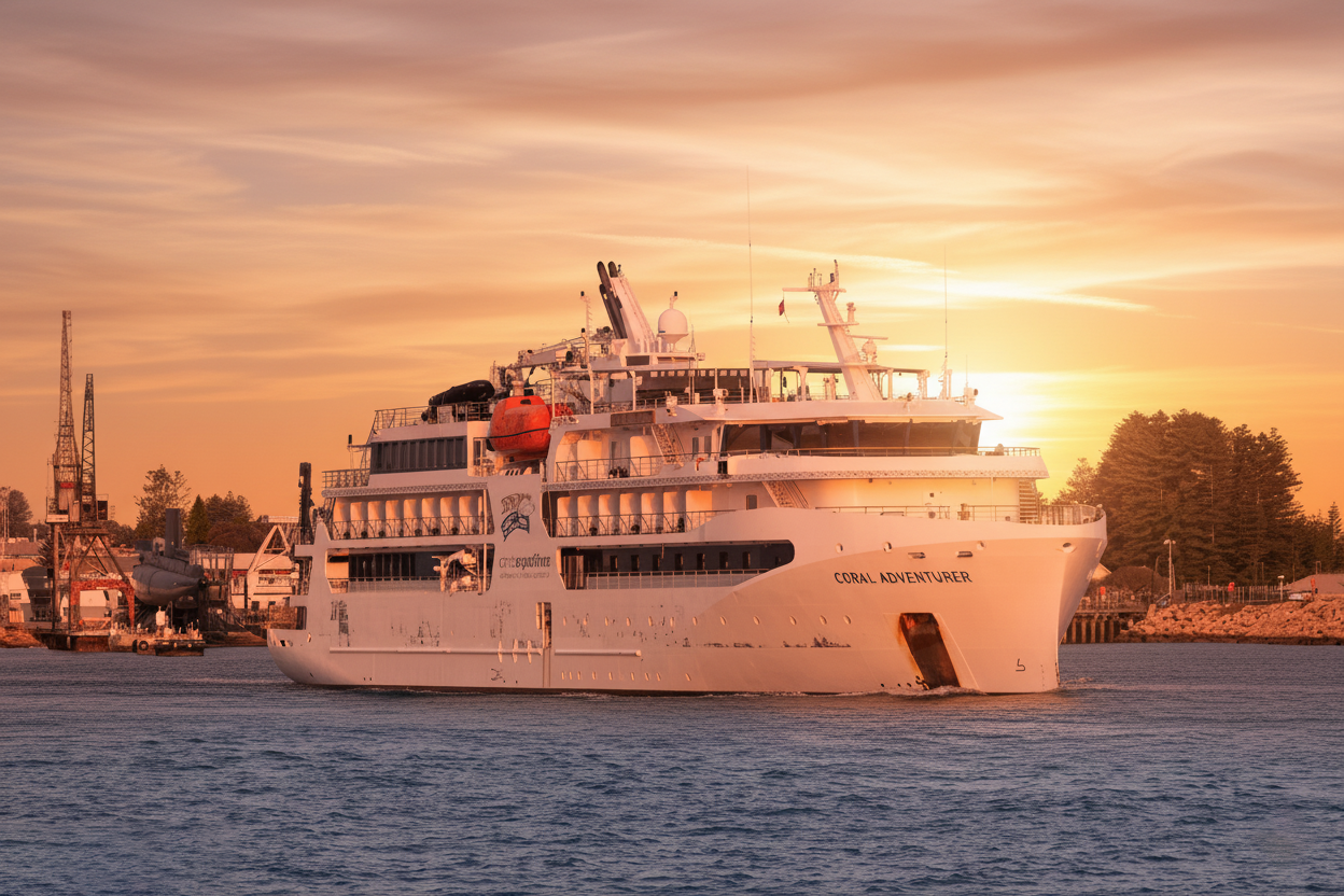
On December 26, 2025, the Australian expedition cruise vessel Coral Adventurer ran aground on an uncharted coral reef off the northern coast of Papua New Guinea, near the conflict-prone region of Bougainville. The incident occurred during a scheduled voyage through the remote and poorly charted waters of the Bismarck Sea.
The 72-meter vessel, operated by Coral Expeditions, was carrying 120 passengers (mainly Australian and international tourists) and 46 crew members at the time of grounding. The ship struck the reef shortly after 1400 local time while navigating through a passage that, according to preliminary reports, was not accurately represented on the electronic charts in use.
No injuries were reported among passengers or crew. The hull remained intact with no signs of pollution or oil leakage. The vessel took on a slight list, but all watertight compartments stayed dry. Passengers were safely mustered and remained calm throughout the event.
Initial response was coordinated by the ship's crew and supported by local authorities in Bougainville. Two Australian Border Force vessels operating nearby were diverted to the scene to provide standby assistance. By the evening of December 27, a large commercial tug with towing and salvage capability arrived on site. High tide and favourable weather conditions on December 28 allowed the vessel to be refloated with tug assistance and minimal hull damage. After underwater inspection, Coral Adventurer proceeded under her own power to a sheltered anchorage for further assessment.
Key factors believed to have contributed to the grounding include:
- Extremely limited and outdated hydrographic data for many areas around the Solomon Islands, Bougainville, and northern Papua New Guinea
- Reliance on electronic charts that may not reflect recent coral growth or uncharted hazards
- Navigation in daylight but in waters with poor visual bottom discrimination due to depth and water clarity
- The challenge of maintaining safe passing distances when charted channels are narrow and surrounded by extensive fringing reefs
This incident serves as an important reminder for all seafarers operating in poorly surveyed tropical waters:
- Always cross-check electronic charts with the largest scale paper charts available and official sailing directions.
- Treat areas marked as "unsurveyed" or with sparse soundings as high-risk zones requiring extra caution.
- Use all available means of position fixing, including radar parallel indexing, visual bearings, and echo-sounding profiles.
- Maintain generous CPA to charted hazards and reduce speed significantly in doubtful areas.
- Brief the bridge team thoroughly on potential uncharted coral heads, especially during the transition from deep water to coastal passages.
- Consider daylight-only navigation and favourable tidal conditions when transiting inadequately surveyed regions.
The Australian Maritime Safety Authority (AMSA) and Papua New Guinea authorities have opened a joint investigation into the circumstances of the grounding.
Source: Compiled from MarineTraffic, Coral Expeditions statements, AMSA updates, and local PNG media reports (December 2025).
There are no comments.
Similar Posts
-
How a Single Minor Component Failure Triggered Grounding, Sinking, and Port Blockage
June 1, 2026, 8:04 p.m.
-
Fumigation Tragedy at Sea: Fatal Phosphine Poisoning Claims Lives of Chief and Third Officers
May 12, 2026, 9:26 a.m.
-
SAFER PILOT TRANSFER OPERATIONS: UNDERSTANDING THE NEW SOLAS V/23 AMENDMENTS
April 25, 2026, 6:55 p.m.